

Black Peak Expedition
Region
Uttarakhand
Duration
18 Days, 17 Nights
Difficulty
Expedition (Highly Difficult)
Altitude
20,950 ft.
Distance
98 KM
Trek Price: ₹80,000
Add-ons
| Items | Price (₹) | Items | Price (₹) |
|---|---|---|---|
| River Rafting (with Safety Kayaker) | 1500 | Bungee Jumping | 2500 |
| Offloading (Backpack) | 1600 | Single Occupancy Tent | 1600 |
| Trekking Shoes Rental | 550 | Down Jacket Rental | 550 |
| Trekking Pole Rental | 250 | Poncho / Rain Cover | 200 |
| Gloves | 200 | Thermal Water Bottle | 300 |
| Insurance | 100 / day |
Overview
History and Legends of the Black Peak Expedition
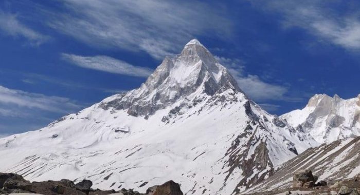
The Black Peak Expedition, also known as Kalanag Peak Expedition (6,387 m), is one of the most revered climbs in the Bandarpunch range of the Garhwal Himalayas. The name “Kalanag” means “Black Serpent”, inspired by the mountain’s dark, curved summit that resembles a serpent’s hood.
According to local legends, this peak is believed to be connected to Lord Shiva, who is often depicted with a black serpent around his neck. Locals consider the mountain sacred, symbolizing strength, mystery, and divine power. The surrounding valleys are also tied to ancient tales from the Mahabharata, where the Pandavas are said to have traversed these regions on their final journey to heaven.
First attempted by British climbers in the mid-20th century, Black Peak has since become a symbol of challenge and reverence for mountaineers. It stands as a rare blend of mythology, history, and extreme adventure in the heart of the Indian Himalayas.
Short Itinerary
Short Itinerary – Black Peak Expedition (6,387 m)
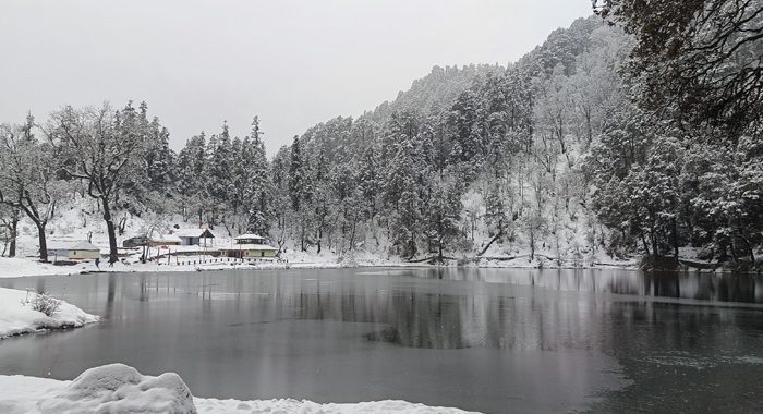
Day 1: Arrival at Sankri
- Expedition briefing and overnight stay
Day 2: Sankri → Dhatmeer (Drive) → Seema (Trek)
- Drive to Dhatmeer and trek to Seema Camp
Day 3: Seema → Ruinsara Tal
- Trek to the beautiful Ruinsara Lake
Day 4: Ruinsara Tal → Kyar Koti Base Camp
- Reach Black Peak Base Camp
Day 5: Rest & Acclimatization at Base Camp
Day 6: Load Ferry to Advanced Base Camp (ABC)
Day 7: Second Load Ferry to ABC
Day 8: Shift Camp to ABC
Day 9: Load Ferry & Route Opening to Camp 1
Day 10: Second Load Ferry to Camp 1
Day 11: Rest Day at Camp 1
Day 12: Route Opening to Summit Camp
Day 13: Camp 1 → Summit Camp
Day 14: Summit Push & Return to ABC
Day 15: ABC → Base Camp
Day 16: Rest Day at Base Camp
Day 17: Base Camp → Devsu Bugyal
Day 18: Devsu Bugyal → Sankri & Departure
Detailed Itinerary
Black Peak Expedition – Detailed Itinerary
Day 1: Arrival at Sankri
Participants arrive at Sankri, a picturesque Himalayan village that serves as the starting point of the Black Peak Expedition. After check-in, the expedition leader conducts a detailed briefing covering the route, safety protocols, equipment checks, and acclimatization guidelines. Overnight stay at Sankri.
Day 2: Sankri to Dhatmeer Drive and Trek to Seema
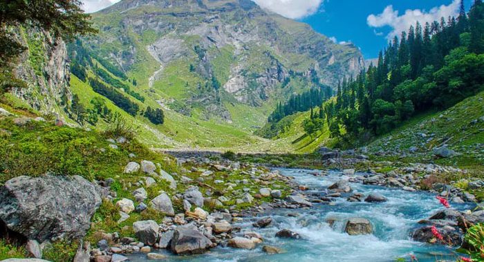
After breakfast, drive from Sankri to Dhatmeer, the road head for the expedition. From Dhatmeer, begin the trek towards Seema through dense forests, traditional villages, and scenic mountain trails. The route follows the Supin River and offers beautiful views of the surrounding valleys. Overnight stay at Seema Camp.
Day 3: Seema to Ruinsara Tal
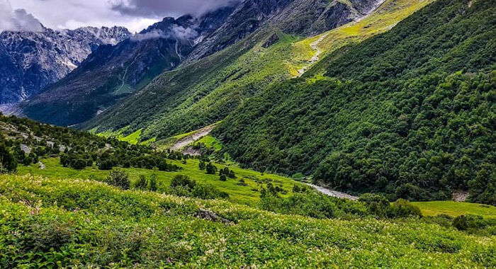
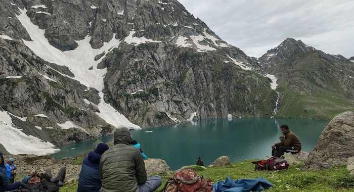
Today’s trek leads to the breathtaking Ruinsara Tal, one of the most beautiful high-altitude lakes in the Garhwal Himalayas. The trail passes through alpine forests, meadows, and streams before reaching the lake. The campsite offers magnificent views of snow-clad peaks and pristine wilderness. Overnight stay near Ruinsara Tal.
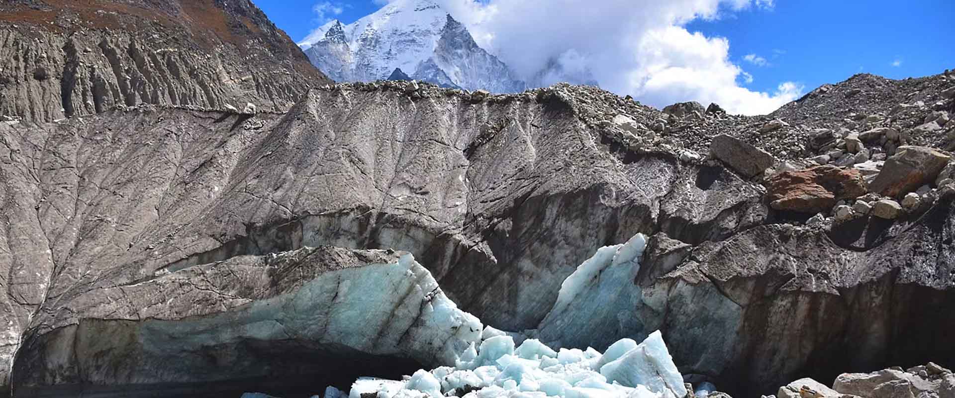
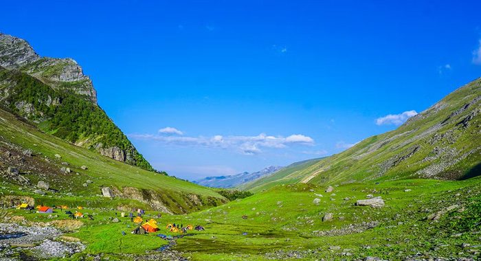
Day 4: Ruinsara Tal to Kyar Koti Base Camp
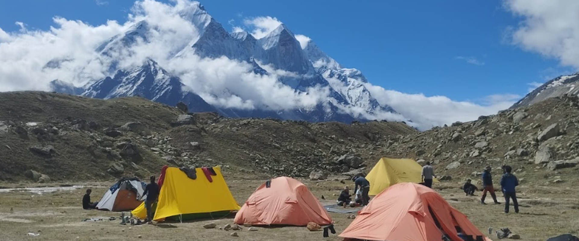
The expedition continues towards Kyar Koti, the Base Camp for Black Peak. The trail gradually gains altitude and moves through glacial terrain and rugged landscapes. Upon arrival at Base Camp, participants settle in and prepare for the climbing phase of the expedition. Overnight stay at Base Camp.
Day 5: Rest and Acclimatization Day at Base Camp
A full day is reserved for acclimatization and technical preparation. Team members practice mountaineering techniques, review climbing equipment, and take short acclimatization walks around the campsite. Proper acclimatization is essential before moving higher. Overnight stay at Base Camp.
Day 6: First Load Ferry to Advanced Base Camp (ABC)
The team carries a portion of expedition equipment and supplies to the Advanced Base Camp (ABC). After depositing the load, members return to Base Camp for the night. This load-ferry process helps with acclimatization and camp establishment.
Day 7: Second Load Ferry to Advanced Base Camp
A second ferry is conducted to transport remaining gear, food, ropes, and technical equipment to ABC. The team returns to Base Camp after completing the task. Overnight stay at Base Camp.
Day 8: Shift from Base Camp to Advanced Base Camp
After breakfast, the expedition shifts completely to Advanced Base Camp. The route involves navigating moraine fields and glacial terrain. Upon arrival, camp is established and preparations begin for the higher camps. Overnight stay at ABC.
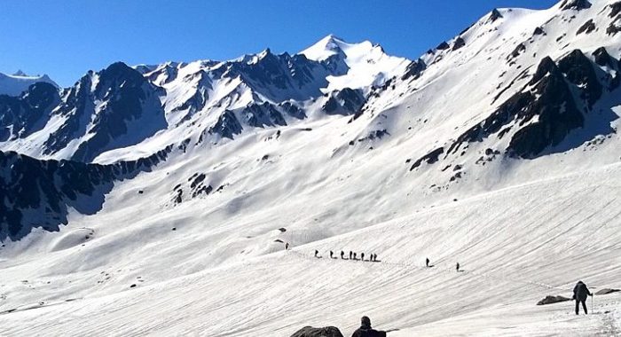
Day 9: Load Ferry and Route Opening to Camp 1
The climbing team carries equipment to Camp 1 while opening and securing the route. Depending on snow and glacier conditions, fixed ropes may be installed in technical sections. After completing the ferry, the team returns to ABC. Overnight stay at ABC.
Day 10: Second Load Ferry to Camp 1
The remaining supplies and climbing gear are transported to Camp 1. Team members continue acclimatization while familiarizing themselves with the route. Overnight stay at ABC.
Day 11: Rest Day at Camp 1
A rest and acclimatization day is scheduled. Sherpas and support staff continue logistical preparations for the summit phase. Weather conditions are monitored closely. Overnight stay at Camp 1.
Day 12: Route Opening to Summit Camp
The route from Camp 1 to Summit Camp is explored, secured, and prepared. Team members may move higher for acclimatization before returning to camp. Final summit preparations are completed. Overnight stay at Camp 1.
Day 13: Camp 1 to Summit Camp
The expedition moves from Camp 1 to Summit Camp. The route becomes steeper and more technical, requiring the use of mountaineering equipment. Upon arrival, climbers rest, hydrate, and prepare for the summit attempt. Overnight stay at Summit Camp.
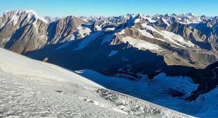
Day 14: Summit Day – Black Peak (6,387 m)
The summit push begins in the early hours before dawn. Climbers ascend snow slopes, glacier sections, and exposed ridges to reach the summit of Black Peak (Kala Nag), one of the most prominent peaks in the Garhwal Himalayas. The summit offers spectacular views of Bandarpoonch, Swargarohini, and other Himalayan giants. After spending a short time at the top, the team descends carefully to Advanced Base Camp. Overnight stay at ABC.
Day 15: Advanced Base Camp to Base Camp
The expedition begins its descent phase. Camp is dismantled and the team returns to Kyar Koti Base Camp while enjoying the dramatic mountain scenery one last time. Overnight stay at Base Camp.
Day 16: Rest Day at Base Camp
An additional day is kept as a buffer for weather delays or recovery. Team members can relax, organize equipment, and enjoy the surroundings. Overnight stay at Base Camp.
Day 17: Base Camp to Devsu Bugyal
The trek descends towards the stunning alpine meadows of Devsu Bugyal. The route passes through glacial valleys, streams, and high-altitude landscapes. Overnight camping at Devsu Bugyal.
Day 18: Devsu Bugyal to Sankri and Departure
On the final day, trek down to Sankri through beautiful forests and mountain trails. Upon reaching Sankri, the expedition concludes and participants depart with unforgettable memories of a successful Black Peak Expedition.
Rental Gear List (Pre-booking required)
- Trekking Poles: ₹200 (adjustable) / ₹150 (fixed)
- RainPoncho: ₹200
- Flask: ₹300
- Gloves: ₹150/₹250
- LunchBox&Tiffin Boxes: ₹250
- Headlamps: ₹150
- Extra WarmJackets: ₹550
- Trekking Shoes: ₹550
- Trekking Pants: ₹450
Note: Reserve rental gear in advance. Rental fees may apply.
Packing Essentials
- Clothing: Layered clothing, warm jacket, raincoat/poncho, trekking pants, quick-dry t-shirts.
- Footwear: Good trekking shoes, extra socks.
- Accessories: Cap/hat, gloves, sunglasses, trekking poles
- Backpack: 20-30L daypack
- Camping Gear: Tents, sleeping bags (provided by Himalayan Derive)
- Other Essentials: Water bottle, energy bars, personal medications, toiletries, sunscreen, headlamp/torch, camera
Fitness & Preparation Tips
- Prepare with cardio and strength training for better stamina
- Permits: Arranged by Himalayan Derive
- Weather: Check forecasts before packing
- Guides: Experienced trek leaders ensure a safe and informative journey
Inclusions
- Hotel in Sankri on arrival day and dispersal day.
- Pickup and drop from Dehradun to Dehradun.
- Imf permissions and forest permissions.
- Food and accommodation in expedition.
- Sherpas and climbing team
- Kitchen staff ,supporting staff & potters
- Central climbing equipments
- Personal climbing gears
- Satellite call facility(chargeable)
Exclusions
- Personal potter
- Personal clothing and accessories of Mountains.
- Heli rescue.
- Accidental insurance
- Medical certificate
Registration Formalities
- Advance 20% of total amount of per person expedition cost for registration. because we have to book the seat in imf then we will have a climbing permit.
- Individuals has to generate there profile on ‘IMF’ website because we need your “login id” to add in you team.
- Individuals have to make there “Adventure accidental insurance” from i.e- (ASC360) & medical certificate. And summit the policy & medical certificate to us on reporting day.